GNSS Receivers: Unlocking the Power of Global Navigation Satellite Systems
The Philippines is a nation brimming with potential, with a growing economy and a population that demands modern and efficient infrastructure. As the country embarks on ambitious infrastructure projects to support its development, advanced surveying and positioning technologies are becoming indispensable. In this blog, we will explore how Topcon Total Stations and Global Navigation Satellite Systems (GNSS) can play a pivotal role in boosting infrastructure projects across the Philippines, leading to enhanced accuracy, efficiency, and overall success.
Introduction: Navigating the World with GNSS Receivers
In today's fast-paced world, accurate and reliable navigation systems have become indispensable for various industries and everyday life. The advent of Global Navigation Satellite Systems (GNSS) has revolutionized the way we navigate, enabling us to pinpoint locations with unprecedented precision. At the heart of this technology lie GNSS receivers, which play a vital role in capturing satellite signals and determining the user's position. In this article, we delve into the world of GNSS receivers and explore their fascinating capabilities, applications, and answer some commonly asked questions.
.jpg)

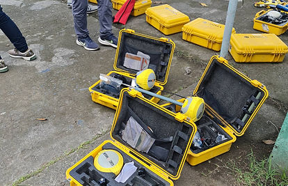
GNSS Receivers: Understanding the Basics
Before diving into the intricacies of GNSS receivers, let's first gain a clear understanding of their fundamental function. GNSS receivers are electronic devices that receive signals from a constellation of satellites orbiting the Earth and utilize these signals to calculate the user's precise location, velocity, and time. By analyzing the time it takes for signals to reach the receiver from multiple satellites, these devices can accurately determine the user's position on the Earth's surface.
How Do GNSS Receivers Work?
GNSS receivers employ a technique called trilateration to calculate their position. This process involves measuring the distance between the receiver and a minimum of four satellites in the constellation. Each satellite emits a signal containing its precise location and timing information. The receiver captures these signals and calculates the time it took for them to reach its location based on the speed of light. By using the measured time differences between various satellite signals, the receiver can determine its position with remarkable accuracy.
The Importance of GNSS Receivers
The significance of GNSS receivers extends far beyond simple navigation. These receivers have transformed the way we conduct various activities, revolutionizing sectors such as transportation, surveying, agriculture, and even personal fitness tracking. The precise positioning data provided by GNSS receivers has enabled the development of sophisticated applications that optimize efficiency, enhance safety, and streamline operations across multiple industries.
Applications of GNSS Receivers
The versatility of GNSS receivers has paved the way for their integration into a wide range of applications. Let's explore some of the most notable uses of these receivers in different industries:
1. Land Surveying and Mapping
In the field of land surveying and mapping, GNSS receivers have become essential tools. Surveyors can accurately determine property boundaries, perform topographic surveys, and create accurate maps by utilizing the precise positioning data provided by these receivers. This technology enables them to increase efficiency and reduce errors in their measurements, resulting in more accurate and reliable survey data.
2. Transportation and Navigation
From airplanes to ships and road vehicles, GNSS receivers have revolutionized navigation in the transportation industry. These receivers provide real-time positioning information to pilots, captains, and drivers, enabling them to navigate accurately and safely. Additionally, GNSS receivers facilitate traffic management systems, tracking vehicle positions, and providing routing suggestions to optimize traffic flow.
3. Precision Agriculture
In the agricultural sector, GNSS receivers have significantly contributed to the development of precision farming techniques. By precisely tracking the location of farming equipment, such as tractors and sprayers, farmers can optimize the application of fertilizers, pesticides, and irrigation. This not only reduces costs but also minimizes environmental impact while maximizing crop yield.
4. Disaster Management
During natural disasters or emergencies, GNSS receivers play a critical role in coordinating rescue operations and response efforts. Emergency services can utilize these receivers to accurately determine the locations of individuals in distress or track the movement of rescue teams. This information ensures efficient deployment of resources and enhances the safety and effectiveness of rescue operations.
5. Personal Navigation and Fitness Tracking
GNSS receivers are now commonplace in personal navigation devices and fitness trackers. These receivers allow individuals to accurately track their outdoor activities, such as hiking, cycling, or running, providing real-time information on distance covered, speed, and elevation. Furthermore, they enable users to navigate unfamiliar areas confidently, ensuring they never lose their way.

FAQs about GNSS Receivers
-
What is the difference between GPS and GNSS receivers?
-
GPS (Global Positioning System) is a specific GNSS developed and operated by the United States. GNSS refers to a collective term encompassing multiple satellite systems, including GPS, GLONASS (Russia), Galileo (European Union), and BeiDou (China).
-
-
Can GNSS receivers work indoors or in obstructed areas?
-
GNSS receivers require a clear view of the sky to receive signals from satellites. In obstructed areas or indoors, where satellite signals may be weakened or blocked, the receiver's accuracy may decrease significantly.
-
-
What is the accuracy of GNSS receivers?
-
The accuracy of GNSS receivers can vary depending on several factors, including the quality of the receiver, satellite geometry, and atmospheric conditions. However, modern high-precision GNSS receivers can achieve sub-meter accuracy in optimal conditions.
-
-
Do GNSS receivers require an internet connection?
-
No, GNSS receivers do not require an internet connection to determine the user's position. They solely rely on satellite signals for positioning information. However, an internet connection may be necessary for certain applications that utilize additional data or services.
-
-
Can GNSS receivers track movement in real-time?
-
Yes, GNSS receivers can track movement in real-time by continuously receiving and processing satellite signals. This feature enables applications such as vehicle tracking, fleet management, and real-time navigation guidance.
-
-
Are GNSS receivers affected by weather conditions?
-
While GNSS receivers can be affected by adverse weather conditions such as heavy rain or thick cloud cover, modern receivers employ advanced signal processing techniques to mitigate signal degradation and maintain accuracy even in challenging environments.
-
Conclusion
GNSS receivers have revolutionized the way we navigate and interact with the world around us. Their ability to capture satellite signals and calculate precise positions has expanded their applications into numerous industries, from transportation and agriculture to surveying and personal navigation. As technology continues to advance, GNSS receivers will further enhance our ability to navigate, optimize operations, and improve safety. With their continuous development, we can expect even greater innovation and integration of GNSS receivers into various aspects of our lives.